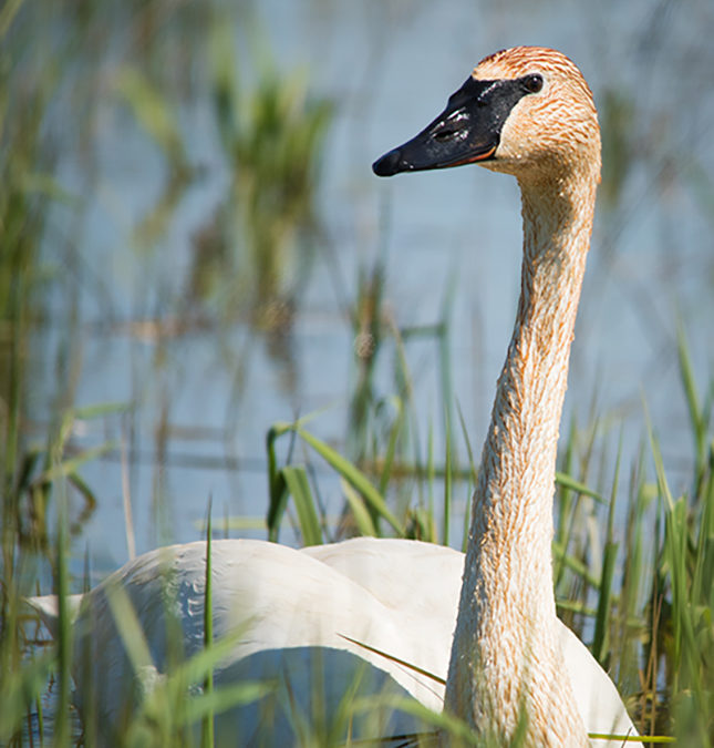
Status of Trumpeter Swans in Ohio
RECENT OHIO BIRD RECORDS COMMITTEE ACTION REGARDING THE STATUS OF TRUMPETER SWAN IN OHIO
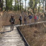
In October 2021, the nine member peer-review panel Ohio Bird Records Committee (OBRC) voted unanimously to remove Trumpeter Swan from it’s list of Review Species in Ohio, determining that the species is now firmly established here, and is likely to remain as an Ohio resident. Details of this decision, the thought process behind it, and the current status of Trumpeter Swan in Ohio, follows.
The true status of Trumpeter Swan has long perplexed naturalists in Ohio, but we are not alone…the same is true throughout much of eastern North America. Since the earliest days of journaling and record keeping, the species has been the subject of conflicting reports, but little hard evidence, across this large area. For thorough and well-researched background information, prepared in large part for this Committee years ago by the late Bill Whan, see the articles linked at the end of this review.
In short, there is no direct evidence which indicates that Trumpeter Swan ever nested in Ohio historically, although it certainly was at least a rare migrant through the 1800s.
Trumpeter Swan is already Accepted on the Ohio list (based on historical data) by the OBRC, and has likewise long been accepted by earlier authorities. This Committee recognizes the last wild Trumpeter Swan in Ohio as being shot in Jackson County in April, 1900. In this case, “wild” pertains to an individual emanating from a naturally occurring population. Due to its nearly 100-year absence as a wild species in Ohio, Trumpeter Swan has therefore held a place on the OBRC’s Review List, and received special attention, since the Committee was formed in 1991.
In 1996, however, the Ohio Division of Wildlife, in cooperation with other partners, and in the pattern of other state and provincial wildlife agencies nearby, introduced Trumpeter Swan into Ohio with the intention that it would become a permanent part of Ohio’s avifauna. This action, of course, added a layer of complexity which affects our abilities to discern the potential “wildness” of Trumpeters seen here…as numbers of Ohio-introduced Trumpeters, their progeny, and introduced and reintroduced emigrants continue to increase here, our ability to detect and discern birds potentially from naturally occurring populations continues to decrease to the point of becoming practically unachievable.
Nonetheless, the OBRC has retained Trumpeter Swan on the Review List until now, in hopes of gathering data on any potentially wild individuals, but also more realistically to gather information on introduced populations as they might fare locally after direct human intervention had ended. Over 25 years have now passed since introduction efforts began here in Ohio, and patterns of occurrence have emerged.
Therefore, it seemed appropriate for this Committee to reassess the data concerning the current status of Trumpeter Swan in Ohio, and to vote whether to retain or remove the species from the Review List. A vote to remove would result in the species no longer receiving special treatment by the Committee.
We have gathered data from numerous sources, including publications by the Ohio Division of Wildlife, eBird, the monthly bird census at Ottawa National Wildlife Refuge, The Ohio Cardinal, and numerous knowledgeable individuals. We are especially grateful for the tireless work done by former OBRC member Dan Sanders on the Committee’s behalf, with his careful determinations of nesting successes of swans across the state.
OHIO DIVISION OF WILDLIFE RELEASE EFFORTS
According to Laura Kearns, Wildlife Biologist with the Ohio Division of Wildlife, 15 Trumpeter Swans were released at Magee Marsh Wildlife Area in 1996. Additional releases occurring from 1997 to 2003 placed birds at a total of 11 Ohio sites considered to be suitable wetlands, with approximately 150 birds being released in total. By 2003, 15 breeding pairs statewide fulfilled goals which allowed for a discontinuation of release efforts by the state, although other licensed propagators still exist locally.
Monitoring continued, and by 2013 fulfilled goals (including 35 breeding pairs) allowed Trumpeter Swan to be shifted from the state’s Endangered List to it’s Threatened List, according to ODOW guidelines. By July 2014, the ODOW tallied 246 individuals statewide, with nearly 140 cygnets being produced in that year alone, and with new locations being utilized by nesting pairs.
Numbers continue to increase, according to the ODOW. By 2020, 98 pairs were surveyed statewide with 235 cygnets being raised. Over the previous five years, the state averaged a 14.7% increase in raised cygnets, but in 2020, that number increased to 19.9%. The total population of Trumpeters in Ohio in 2020 was estimated at 650 individuals, and in 2021, nesting pairs have surpassed the 100 mark. Nesting range has continued to increase as well, although peak numbers still reside in the northwestern Ohio Lake Erie marshes.
Also in 2020, 12 Ohio Trumpeters were fitted with GPS-tracking neck collars, and their movements, as well as the movements of over 100 other swans collared in five midwestern states and Manitoba, are now viewable online at <https://trumpeterswan.netlify.app/locations.html>. Although no ingress or egress of GPS-collared swans has been noted for Ohio (rather, only short-distance tracked movements have been noted here), longer distance movements in other areas indicate that given a larger sample size, movements into and out of Ohio could certainly be occurring (in fact, they are occurring– the Ottawa NWR monthly census has identified two Trumpeters, in 2019 and 2021, with unique wing tag markings establishing origins in Ontario, Canada).
According to the attainment of ODOW management plan goals, Trumpeter Swan is now eligible to be removed from the state’s Threatened List, although this has not yet occurred.
DATA FROM THE OTTAWA NATIONAL WILDLIFE REFUGE MONTHLY BIRD CENSUS
This census covers a prescribed route, and is run monthly year-round, through the marshes of Ottawa NWR in Ottawa and Lucas counties. Observers pay special attention to swan numbers of all three local species, and since 2007 have recorded any unique markings visible in the Trumpeters they see. As such, these surveys provide valuable year-round data, as compiled by the late Ed Pierce and Doug Vogus, who graciously has provided us with the information presented here.
One nesting pair of swans, “74M” and “1A2”, has been present there since at least 2007 (and are therefore at least 15 years old), all indicative of the nesting potential for this long-lived species in preferred habitat. Except for an outlier found in 1991, Trumpeters were first detected on the census in 1996, the first year of introduction at adjacent Magee Marsh. Since then, the species has been found there on almost every monthly survey date.
We can conveniently break down the census numbers as follows: during the 5-year period of 1996-2000, a total of 149 swans were tallied. In the next 5-year period, 2001-2005, 470 swans were tallied; from 2006-2010, 1032 were tallied; from 2011-2015, 1564 were tallied; and from 2016-2020, 6470 were tallied.
An average of 30 swans were tallied per year during the period of 1996-2000; 2001-2005 averaged 94 per year; 2006-2010 averaged 206 per year; and 2011-2015 increased the average substantially to 313 per year. Not until the 2016-2020 period did numbers skyrocket, averaging 1294 per year.
The maximum number of Trumpeters on any date was 408 during January 2020.
These numbers very clearly show an increase in Trumpeter Swans at Ottawa NWR, and parallel ODOW increases noted above.
DATA FROM THE OHIO CARDINAL AND EBIRD
From information compiled by Editor Craig Caldwell from eBird and other sources, we can break down data for the past 10 years since 2011. Observers in an average of 15 Ohio counties per season submitted Trumpeter Swan reports for 2011; by 2014, the average was 23 counties per season; by 2017, the average was 26 counties per season; by 2020, the average was up to 33 counties per season. For the Winter 2020/21 and Spring 2021 seasons alone, an average of 49 counties reported Trumpeters. Although an increased number of observers may account for at least a portion of this increase, it also parallels ODOW and ONWR census trajectories, and presumably indicates expanding range necessitated by increasing numbers.
COMMENTS FROM VOTING MEMBERS
Committee members were asked to comment on their voting decisions. The following comments are excerpts taken from the votes of various OBRC members:
1) “The issue of Trumpeter Swan has long been confusing for the public. It is now very well established here and should be countable without attempting to determine where it originated from.”
2) “OBRC’s initial intent of having Trumpeter Swan on the Review species list to gather info on potentially wild individuals seen in Ohio and to gather data on how introduced populations would fare after their introduction by humans was a sound policy. It seems unlikely that the OBRC could have foreseen how the numbers of Trumpeter Swans in Ohio would expand over the next 30 years from 1991 when it was added to the Committee’s list of review species….We then have a responsibility to inform and educate Ohio’s birding community about our decision and how it affects whether they can add Trumpeter Swan to their various lists in Ohio.”
3) “This is about a sustained, viable, and expanding population.”
4) “It is clear that Trumpeter Swans in Ohio are here to stay, at least for the foreseeable future. It is also clear…that it is now close to impossible to determine if any of the swans in Ohio are truly wild strays and not from the introduced population.”
5) “I vote to remove Trumpeter Swan from the OBRC Review List…it can be hard to predict how a species’ populations will change over time. But that’s perfectly okay. To paraphrase a saying, you go with the data you have, not the data you wish you had. If the situation changes, the question can be revisited.”
6) “Simply put, they have been here for more than twenty years…No longer is this species being supplemented by additional release efforts (for some time now) and they don’t rely on humans to continue surviving in the wild.”
7) “Voting [to remove the species from the Review List] is difficult for me since I never approved of the process that brought them here. So I will give the victory to the vibrant species, rather than the process. They are here to stay.”
ON COUNTABILITY IN OHIO
The issue of countability of Trumpeter Swan in Ohio has come up frequently over the years while the species has resided on the Review List. Although it may frequently be viewed as determining countability, the OBRC does not directly serve this function. Rather, according to OBRC Bylaws, the Committee 1) endorses records it determines to be suitable, based on the strength of available evidence, to be included in the historical record; 2) provides a means by which records can gain universal acceptance as scientific data; and 3) establishes standards of observation and reporting against which observers may compare their own techniques.
So, in reality, the Committee provides guidance on which birds it considers countable, but the actual determination to count is done by birders alone.
Birders have treated the countability of Trumpeter Swan in Ohio in a variety of ways. Some have waited to count Trumpeters for their Ohio lists until the OBRC determined that the species was established here. Others have waited to count the species based on interpretations of American Birding Association listing rules (although these rules have changed over the years and are not always easily interpreted). See for instance <www.aba.org/aba-area-reintroduced-indigenous-species/>, which seems to indicate that the ABA believes that Trumpeter Swan should already be countable in Ohio despite confusion over the matter of whether the species is truly indigenous here. Undoubtedly most birders using eBird to record their observations already count Trumpeter here because the platform allows them to be counted. Of course, many birders and nature enthusiasts see a Trumpeter Swan and automatically count it, without considering any background information. Others have simply counted the species using their own inclinations and judgement.
With this vote, the Committee acknowledges the establishment of Trumpeter Swan in Ohio and hopes that the decision to remove the species from the Review List will also remove any questions of countability here.
Although differences of opinion exist regarding whether introduction efforts here were appropriate, one cannot overlook the increasing presence of Trumpeter Swans in Ohio’s wetlands. Further study is certainly warranted, if only to verify future population numbers, but more importantly to better establish how the presence of Trumpeters affects native species, both competing for the same limited tax dollars, and dwelling in the same precious habitats.
For the OBRC,
Rob Harlan, Vice Secretary
For background information, see:
Did Trumpeter Swans Ever Breed in Ohio?
by Bill Whan (2000)
<www.acsu.buffalo.edu/~insrisg/nature/whan_essay.htm> and a 2007 update
<www.acsu.buffalo.edu/~insrisg/nature/WhanTS07.htm>
Did Trumpeter Swans Ever Breed in Eastern North America?
by Bill Whan and Gerry Rising (2001?)
")
")