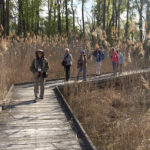
Each month, our OOS Regional Directors are sharing their favorite birding hotspots in their respective regions – and beyond. These include some well-know destinations, specialty spots for specific species, and their own secret, treasured local patches. Have a favorite birding location? Reach out to your OOS Regional Director and let them know!
Jon Cefus – East Central Regional Director
Leesville Lake and Atwood Lake
As I come to the end of my 4-year term of East Central Ohio Regional Director for the Ohio Ornithological Society, I am spending a day birding in a county that is close to my heart. That county is Carroll. My family built a cabin on Leesville Lake in the early 1970’s and it has been one of my favorite places to be.
At one time, Carroll was one of the least birded counties in Ohio when looking at eBird data. In 2016, with the help of my friends Kent Miller and Ben Morrison, we surveyed that county for a full year and were able to add many new bird species to the county records. The following represents a typical route I might take in the month of November, which is often one of the more difficult months to find a good variety of birds, except for waterfowl, which tend to be moving through in good numbers in Ohio depending on weather conditions. For those who like to achieve a certain number of species in a given month, say 100 species for example, November can be a challenge, especially if you are limiting yourself to one county. In November of 2016, I saw 71 species in Carroll County. The following is rather lengthy, as I try to provide details about accessing public areas/roads that I have used over the years.
My morning will begin at Leesville Lake Wildlife Area located on Delta Road SW accessing it on Autumn Rd. SW. on the south shores of Leesville Lake. As is always the case when locating birds in the late fall and winter months in Ohio, I will be listening for Chickadees and Tufted Titmouse, as it is often the case that other birds that spend the winter in Ohio will be associating with them. These might include Golden-crowned Kinglets, Brown Creepers, and Red-breasted Nuthatch. If I find a group of such birds, I will also be paying close attention to see if a lingering Ruby-crowned Kinglet or Hermit Thrush is nearby. Another indicator of an area being productive would be seeing/hearing White-throated Sparrows, which also spend the winter months here. If you are hearing or seeing a nice variety of birds like the above, the habitat is likely holding good food choices for the birds, which provides you a chance of seeing something less common. I think of it like this: birds of multiple feathers flock together in winter in Ohio. This area is generally good for a nice variety of woodpeckers, including Downy, Hairy, Red-bellied, Pileated, Northern Flicker, and Yellow-bellied Sapsucker.
Viewing the water itself at Leesville Lake can be a bit of a challenge, but with patience you can work the available public road access points to get glimpses of the water and find waterfowl. If I begin at Leesville Wildlife Area (Delta Rd. off of Autumn Rd. SW), I will turn right as I leave the wildlife area on Autumn Rd. and go until it dead ends. There is a small pull off at the bottom that you can park at and step out of the car to see a small bay and a bit of the lake. It is a small view, but you are close to there so a quick look cannot hurt. From there, I am going back up Autumn Rd. to the next road on the right past Delta Road, which is Bramble Road. Bramble winds its way down towards the south fork of Leesville Lake. I will be listening for birds as I make my way down, stopping along the way if I hear a group that has potential.
When you hit the “bottom” of Bramble, you will come to an intersection that crosses a creek where Dove Road intersects with Bramble. I turn right on to Dove Rd. and follow it along the lake scanning for waterfowl and listening for woodland birds. It is a dead-end road, but winds nicely along the lake. After checking that, I turn around and go right on Bramble to continue my way along the lake, checking as I go. These roads are quiet and not very busy, but you should be mindful of not blocking other drivers. It is generally fine to be pulled off the right side if you need to stop to scope the lake or listen for birds. As you make your way along during the cold weather months, the lake will give way to becoming the trickle of McGuire Creek, which is the source of the Muskingum Watershed Conservancy District’s creation of Leesville Lake. You will pass Desert Rd. on your left and then come to another intersection with a bridge over the creek. That is Dew Drop Road. I like going up that road partly because of the name, and partly because it is more birding friendly than going out to SR 332 to make my way towards Leesville Dam.
Going up Dew Drop Rd. and birding along the way, you will end up hitting SR 164 (Amsterdam Rd.) where you turn right on that state route heading towards the little town of Leesville. A few miles down the road, SR 164 hits a low spot and you make a hard right turn. Just before you would turn around a hard left corner, a county road will be in front of you. This is CR 115 (Deacon Rd.) and I drive straight up Deacon. Along this section of road is mixed habitat. On your right is wooded areas made up partially of wildlife area around Leesville Lake, and on your left farmlands that often flood in the spring and fall, providing habitat for dabbling ducks, geese, and shorebirds (often wintering Killdeer are here). Eventually, Deacon Rd. opens up to farmland on both sides and becomes CR 22 (Azalea Rd.). Continue on Azalea in the direction you are traveling (basically north) past farms and private homes. The next road on the right, Deer Rd. (CR 116), will take you up to Leesville Dam.
There are a few pull offs along Deer Rd. if you should hear woodland birds you want to investigate. You will peak at the top of the dam as you drive up. You cannot park at that top area legally, but just down from the top on the left is another pull off, which allows a good place to scope the deepest part of the lake. This is where I will generally find diving ducks if they are on the lake. It is also an area that gulls gather. The wooded areas around here and up the road going into the campground and marina area have been productive for Red-breasted Nuthatches over the years. This is also a nesting area for Pine Warblers, so you might get lucky and find a lingering Pine Warbler along this stretch. Eventually, you will loop back around as Deer Rd. dead ends at the marina. I make my way back out past the dam and down Deer Rd. until it ends at Azalea Rd. and I turn right. After a very short distance, you cross the outflow of McGuire Creek from the dam on a small bridge and I turn left back on to Deer Rd. to make my way out along the creek to SR 212 (Cumberland Rd.). Watch for Mallards and American Black Ducks in the creek, especially if the lake is icy.
I turn right off of Deer Rd. on to SR 212 going towards the little town of Sherrodsville to make my way to Atwood Lake. Atwood Lake has areas in both Carroll and Tuscarawas Counties. If you want to be able to look at the deepest water area of Atwood, then checking the area by the dam is essential, and that area is in Tuscarawas County. I follow SR 212 into Sherrodsville and then turn right to stay on SR 212/SR 39 east. Go east through Sherrodsville and as you are leaving town SR 212 goes off to the left, take that left. You will go a few miles, past SR 542, and you will see the dam area with a sign at the access road to a large boat launch/parking area. This is a good spot to scope the west end of Atwood Lake, all of which is in Tuscarawas County. Generally speaking, most any bird you can make out with a scope looking east from the dam parking lot is in Tuscarawas County. The Carroll County line stretches across the lake near the Atwood Lake Park beach area, which is pretty far east up the lake from the dam.
After I scope from the dam area, I generally make my way back into Carroll County by backtracking on SR 212 towards Sherrodsville and then turning left on to SR 542 going towards the little town of Dellroy. I drive a few miles along SR 542. You will approach a corner where the lake comes into view on your left. There is a small pull off there that I often look at the lake from, but you need to be very careful using that spot, as traffic is usually moving pretty fast. Safety first when birding, always. Less than a mile more along SR 542 is an unmarked road on your left that provides a point of access to some wooded areas by the lake. You can safely pull off and park here if you like and then walk up a paved road that usually has sawhorses to prevent vehicles from driving up there. I am not sure what the intent of this area was for Muskingum Watershed Conservancy District, but the road represents a little peninsula with trees and brush, and it can be pretty good for birds with water being nearby and shelter from winds.
After checking this area, I go back to SR 542 and continue east towards Dellroy. Once I get to Dellroy and the only traffic light in town, I have to make a decision. There are multiple options at this end of the lake. For those who want to look at the inflow of the lake, Indian Fork Creek runs into the lake from east end of town, so you can drive straight through town, now on SR 39 east, and as you leave town you will see Glendale Rd. SW (CR 159) on your left. Going down that road will take you to the inflow of the creek and some marshy habitat, which often holds wintering Swamp Sparrows and other half-hardy wintering birds. I usually check this spot. When done here, I go back up to SR 39 and turn right back into Dellroy. When I get to the traffic light, I turn right on SR 542, which leaves town and takes you across a causeway that divides the lake with the inflow of Indian Fork on your right and the lake opening up on your left. In winter months, this area will only be a trickle of water and mostly mudflats.
Just past the end of the causeway on your left is a large pull off, often with trucks parked there. In winter months, you might see larger flocks of gulls foraging on the mudflats. In the summer months, you can watch Ospreys tending to a nest on a man-made nesting platform. I have often seen Bonaparte’s Gulls foraging this part of the lake. After looking at this area, I continue along SR 542. My next stop will be the Atwood East Marina. You will note that the water levels are getting deeper as you reach this area. There is ample parking at the marina, and you can scope a fair amount of this part of the lake from here. Often in the winter I will see Common Mergansers and other diving ducks looking west from the marina parking area. I then continue along SR 542 a little way and past Fawn Rd. SW after a long sweeping corner I turn left down a small access road to a little parking lot at another part of the lake where the land projects out, giving a pretty good look at quite a bit of water. This little parking lot is before you get to Whispering Pines Ln. SW, so if you see that on your right you went too far. I park, walk out the path with my scope, and scan the lake.
I then continue on my way along SR 542 and cross another causeway as this part of the lake comes to its end. There are a few pull offs on either side of the road to look at the lake (mudflats in winter months, shallow waters in the warmer months). You can also walk a little way into the woods if you like to listen for birds. The last spot I check at Atwood is a little further along SR 542 as the lake comes to an end, and I turn left on to Tolan Rd. (CR 674). This is a little marsh area, again often with wintering Swamp Sparrows and half-hardy birds. Be mindful that this road ends a private property, as is indicated by signs, so I turn around before getting to that point. I go back to SR 542, turn left and head towards Fargo Rd. SW (CR 143).
I drive on SR 542 for a couple of miles. You will approach a fairly sharp curve climbing up a bit and see the east side of Fargo Rd. on your right, but you want to go past that a bit further and you will see the west end of Fargo Rd. on your left. I turn left there and begin to make my way up Fargo. All of this area is private property on both sides, so be mindful of that. Still, over the years this road has been quite good for birds, both in summer and winter months. You will make your way past a few small farms on the left and pastures on your right. I stop from time to time to listen along the way. You will climb further up with more pasture around you and enter a little area of woods before coming up to a few different intersections (Holly Rd. and Thunder Rd.). You can divert for a little way along these roads if you like to explore, but you will want to come back to Fargo after exploration. Eventually, Fargo will open up more and more and as you pass the last property on the left (a recently restored farm house) you will be entering the grassland area that is reclaimed mine land. This is private property as well, so you should remain on the road, but I often park and walk a bit to scan more carefully and listen for birds.
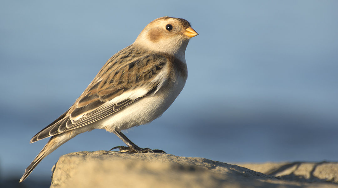
This section of Fargo Rd. is good nesting habitat in the summer months for Henslow’s, Grasshopper, and Savannah Sparrows, as well as Bobolinks and Eastern Meadowlarks. In the winter months, I have seen Northern Harriers, Rough-legged Hawks, Short-eared Owl, Northern Shrike, Horned Larks, and sometimes wintering Eastern Meadowlarks. This area is also potentially good for Snow Buntings and Longspurs. After checking his high point on Fargo, I continue down the road towards the bottom marshy area, which again holds wintering Swamp Sparrows and other potential wintering birds. Fargo “ends” (not really, as it continues after restarting a mile or so to the west) at Briar Rd. and this is where I will end this rather lengthy account of how I bird these particular areas of Carroll (and a little bit of Tuscarawas) County. Turning right on Briar will take you ultimately back to SR 542. Turning left takes you into Tuscarawas County near Cumberland, which is close to the dam along SR 212.
If you decide to follow this route, I wish you luck and hope that my directions are helpful. There are other ways of checking these areas and I have not covered every possible option, as there are many little county roads that go down towards areas of both Leesville and Atwood Lakes. Note that some of these areas have little or no cell phone reception, so be mindful of that. I carry physical maps in my car to supplement this issue, as I am often in areas of Ohio with poor cell service. Restroom access can be a challenge too, but options are indicated on Muskingum Watershed maps that can be found on the Birding in Ohio website, which also contains additional details about some of the areas covered here.
")
")